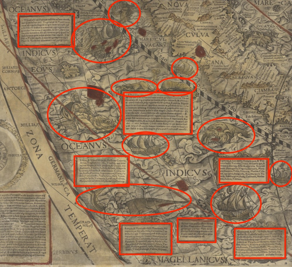
The Indian Ocean is teeming with sea monsters in Caspar Vopel’s 1558 map of the world. A giant swordfish-like creature looks to be on a collision course with a ship, while a walrus with frighteningly large tusks emerges from the water, and a king carrying a flag rides the waves on a hog-faced beast.
Vopel, a German cartographer, left behind no explanation of why he added these things to his map, but he may have been motivated by what art historians call horror vacui, the artist’s fear of leaving unadorned spaces on their work. Chet Van Duzer, a historian of cartography, has found dozens of maps on which cartographers appear to have filled the empty spaces on their maps with non-existent mountains, monsters, cities, and other gratuitous illustrations.

Van Duzer, who presented some of his findings at a recent cartography conference at Stanford University, says that some scholars have been sceptical that this aversion to blank spaces has been an important influence on map design.
But Van Duzer argues that horror vacui was widespread among cartographers, especially during the 16th and 17th centuries. Vopel’s map, for example, includes not only sea monsters and ships but also boxes of text describing features of the land. Vopel could have put this information around the margins of the map, but he chose instead to use them to fill in the oceans. All together these elements take up at least as much space as the part of the world that’s actually being mapped.

One reason mapmakers may have done this is to hide their ignorance, says Van Duzer. When the Dutch mapmaker, Pieter van den Keere, made a world map in 1611 (see above), the interior of North America had yet to be thoroughly mapped. Instead of leaving it blank, van den Keere filled the space with an elaborate cartouche, a decorative oval shape surrounded by alligators, birds, and foliage. At the top of the cartouche, explorers Christopher Columbus, Ferdinand Magellan and Amerigo Vespucci pore over a map (see below).

The interior of Africa was not well mapped either at the time, but there were texts available that described it in detail—albeit speculative and unreliable detail—and van den Keere likely relied on these to fill in the interior of that continent, Van Duzer says. According to the map, for example, the Niger River flows underground for 60 miles and then re-emerges in a lake. In reality it does no such thing.
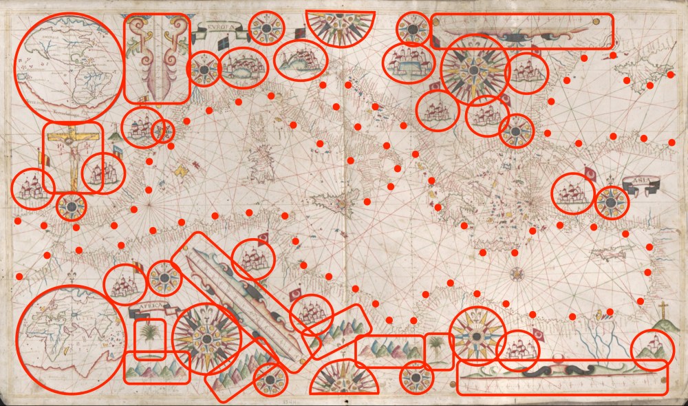
Mapmakers may have also been motivated by the market for their work. Aristocrats and other wealthy patrons who commissioned the most expensive maps would have expected lavish decoration. On the Italian cartographer Giovanni Battista Cavallini’s 1640 colorful nautical chart of the Mediterranean Sea (below), the surrounding land is filled with cities, mountains, and far more scale bars and compass roses than necessary—or even helpful.
Unfortunately, the real motivations of these mapmakers are mostly lost to time. Van Duzer has so far found only one text by a cartographer that discusses horror vacui, although not by name. It’s a small note on a 1592 world map by the Dutch cartographer Petrus Plancius, in which Plancius says, in effect, that he went out of his way to research the constellations of the southern sky for a small celestial map he drew in one corner, “Least the South part of this Hemispheare or halfe Globe, should remaine voide and emptie.”
“The stars of the southern hemisphere were not well known in Europe in the early seventeenth century, so he is proud that he has sources that will enable him to fill in what might otherwise be a blank area,” Van Duzer says.
Even in its heyday, horror vacui seems to have afflicted some cartographers more than others, Van Duzer says. But by the middle of the 18th century, more and more mapmakers were keeping their embellishments to the margins and leaving the seas and unexplored continents unadorned, he says. “Cartographers started to conceive of maps as something more purely scientific.”
This article was originally published on our blog All Over the Map at National Geographic.
