Last year’s drought had Boston worrying anew about a longstanding problem: The foundations beneath centuries-old homes and other buildings are at risk of rotting and crumbling.
It seems counterintuitive that a lack of water would be a problem for foundations, but this odd situation is the result of an unusual facet of Boston’s history: A large portion of the city sits on man-made land. Structures built on the landfill are supported by dozens of 30- to 40-foot-long wood pilings, similar to telephone poles, that reach down through the landfill to a harder layer of clay. These pilings sit entirely below the water table, which protects them from microbes that would attack them in dry air, causing rot.
Water leaking into sewers or tunnels can drop the water table below the pilings even in wet years. But last year’s drought brought the water table dangerously close to the tops of some of these pilings, putting them at greater risk. How did Boston end up in this situation? It all started in the 17th century, not long after the city was established.
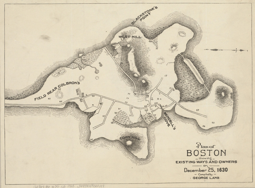
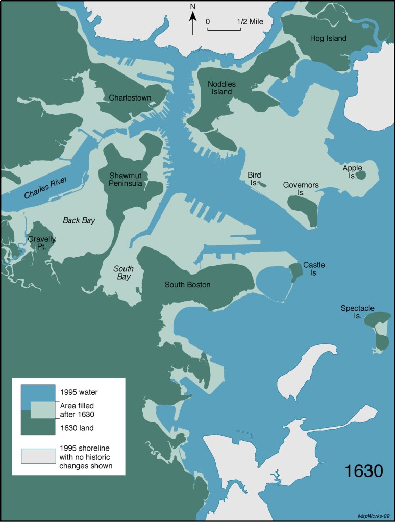
When the Puritans arrived in 1630, much of the land that underlies some of the oldest parts of Boston didn’t exist. They settled on a small peninsula—called Shawmut by Native Americans—that covered less than 800 acres and was connected to the mainland by a narrow neck that became submerged during high tide. It had the advantage of a dependable supply of springwater, and it was well positioned for maritime commerce.
The map above shows the shape of Shawmut when Boston was established in 1630. Shortly thereafter, its inhabitants began to make their peninsula bigger.
Boston’s land-making wasn’t all about the need for more space, writes author Nancy Seasholes in her wonderfully comprehensive book Gaining Ground. Over the years there were many other motivations for making new land, including making harbor improvements, burying pollution from wastewater, safeguarding public health, building public parks, adding railroad tracks and depots, adding more shipping facilities to compete with other port cities, establishing appealing neighborhoods to entice Yankees to stay (and to counter Irish immigration), and creating space for the city’s airport.
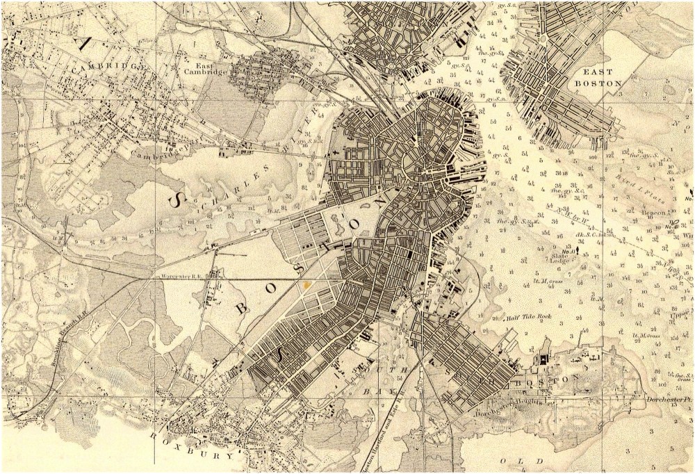
In fact, some of that new land was the unforeseen end result of entirely unrelated endeavors. An early example of this is the story of Mill Pond. In the 1640s, a group of businessmen got permission from the city to build a dam across the mouth of a cove on the northern end of the peninsula, so that they could use the tides to power some flour mills. The dam formed what was known as Mill Pond (see map below), and the mills were up and running by the end of the decade. But they were never very productive, and the whole operation was sold off to another group by the end of the 18th century.
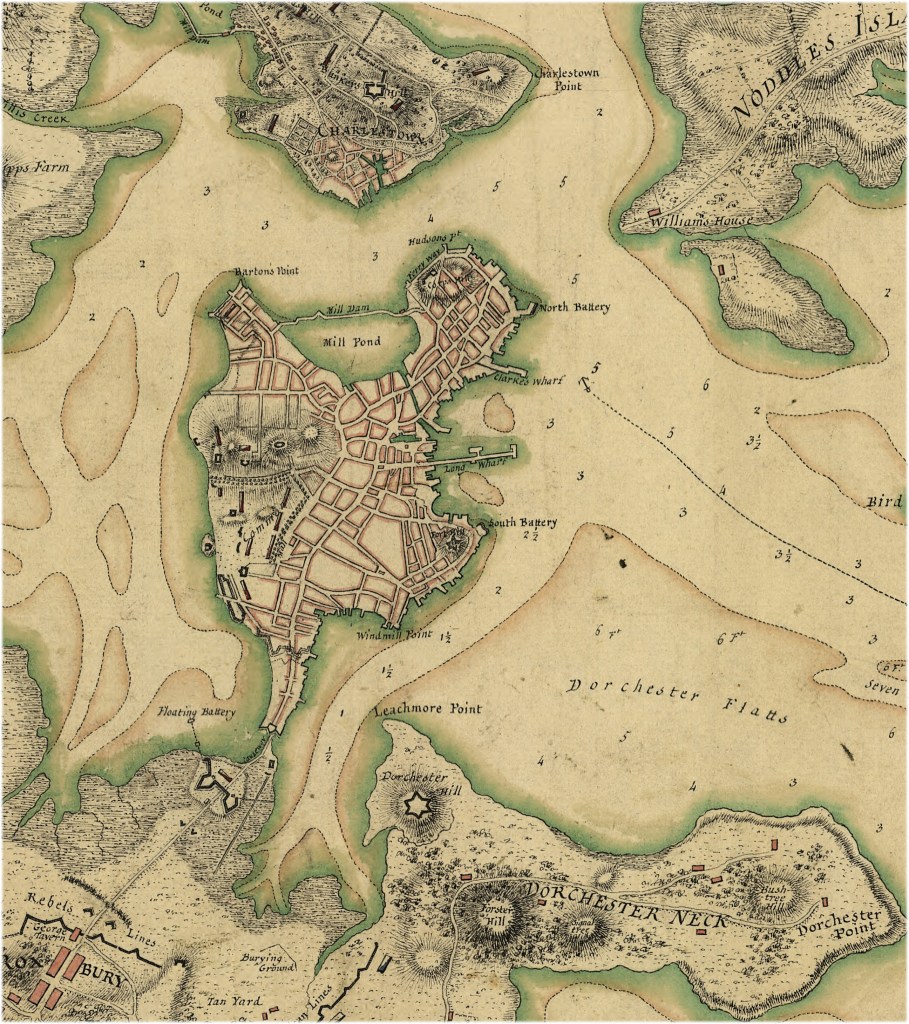
The new mill owners closed the floodgates on the west end of the dam, which reduced flow along the banks of Mill Pond. Consequently, sewage, garbage, and the rotting corpses of discarded animals began to accumulate along the shore. It’s unclear whether letting the filth build up was part of their plan, but the new owners soon began lobbying the city to let them fill in the pond and sell off the land.
Creating more taxable land was appealing, but public-health concerns were also a major issue. At the time, the miasmatic theory of disease—the idea that illness was caused by foul, pestilent odors—had made its way to Boston from England, and undoubtedly influenced the decision to fill in the pond. Bostonians, including local doctors, feared that the stench from Mill Pond would make them sick. Permission was granted, and in 1807 the filling-in began.
Most of the material came from Beacon Hill, whose elevation is currently 60 feet lower than it was before Boston began tearing down its hills to make new land. Today the 50 acres of new land at Mill Pond is known as Bulfinch Triangle, after architect Charles Bulfinch’s triangle-shaped plan for the new streets (visible on the 1826 map below). It became an industrial and commercial zone, and later more land was extended outward from the triangle to support railroad depots.
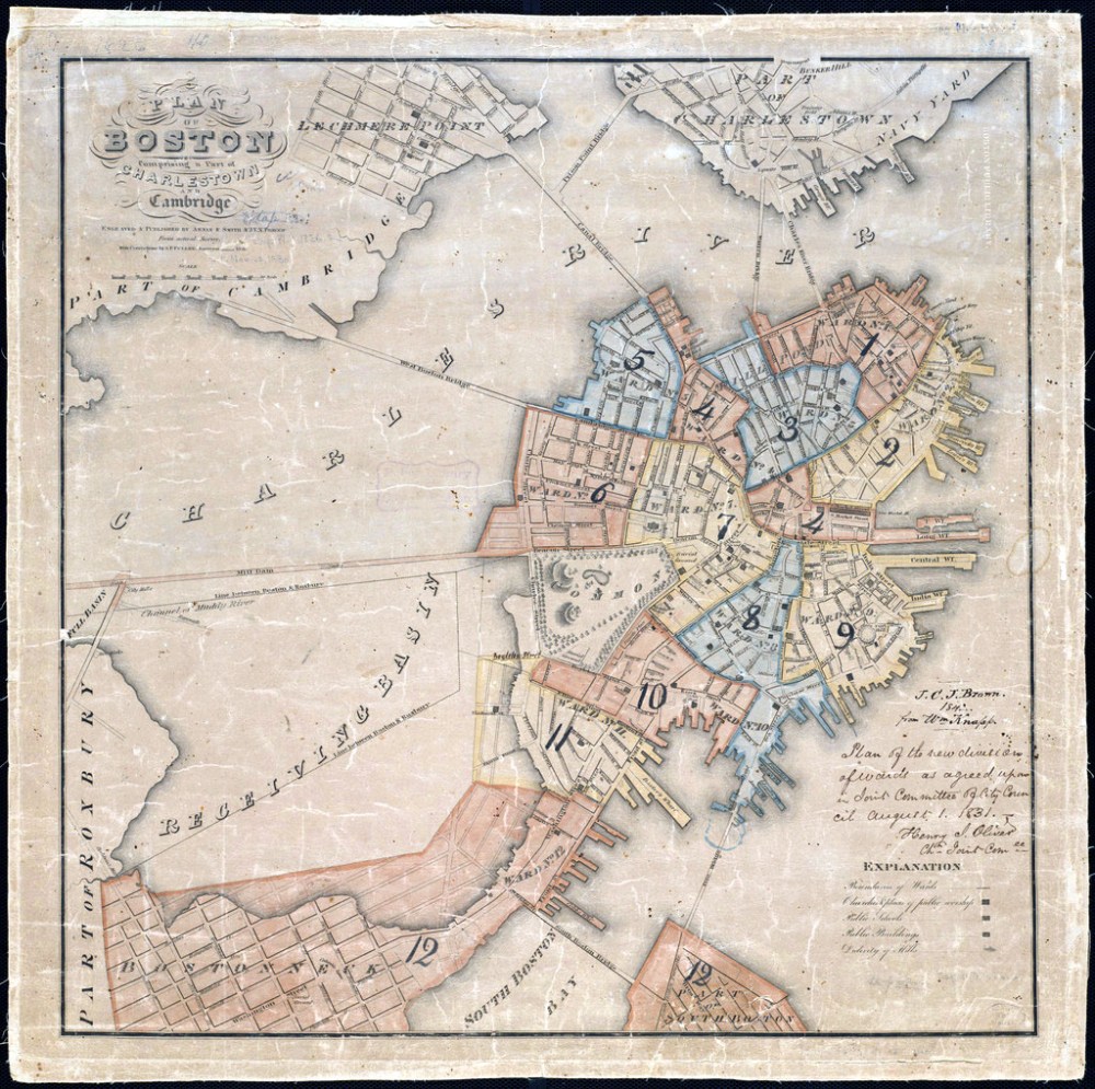
One of the most extensive areas of man-made land in Boston is in the city’s Back Bay neighborhood and surrounding areas. The 150-year history of land-making in this area shares some aspects with the Mill Pond saga, including the initial construction of a dam to power mills in 1822. Back Bay encompassed the large tidal flats on the north side of Boston Neck, which connected Boston to the mainland. Once that area was cordoned off by the dam (as can be seen in the 1826 map above), it was probably inevitable that it would eventually be filled in.
Small pieces of new land began appearing almost immediately. The Boston Public Garden, just west of the Boston Common (see map above) and part of the neighborhood just south of the garden (known today as Bay Village), began growing in the mid-1820s. In the 1830s, railroad lines were built through Back Bay, reducing circulation and hampering the already underwhelming tidal power that could never keep more than a few mills running.
The crisscrossing railroad lines further partitioned the bay (see the map below), and a sewage-fueled stench soon had residents once again decrying the unhealthy miasma wafting into the city. Seasholes’ research into Back Bay uncovered an 1849 report from a city committee that reads: “Back Bay at this hour is nothing less than a great cesspool into which is daily deposited all the filth of a large and constantly increasing population … A greenish scum, many yards wide, stretches along the shores of the Western Avenue [Mill Dam], whilst the surface of the water beyond is seen bubbling like a cauldron with the noxious gases that are exploding from the corrupting mass below.”
In 1850, Bostonians began filling in the bubbling cauldron in earnest (the 1867 Coast Survey map above shows the bay partially filled in). With most of the city’s hills already leveled and made into new land, some parts of Back Bay were filled with trash, mud from the flats of the South Bay on the other side of Boston Neck, and sand and gravel brought in by railroad from Needham, Massachusetts, west of the city. The whole area wasn’t completely filled in until the 1890s.
Today Back Bay is one of the city’s most desirable neighborhoods, but also among the most vulnerable to foundation rot. In 1929, cracks began forming in the grand entryway of the Boston Public Library after leaks into a sewer pipe dropped the water level in that part of Back Bay, causing the tops of many of the structure’s pilings to rot. The cost to fix it was $200,000— a hefty amount at the time.
Since then, around 200 other buildings have had their pilings repaired. A block away from the library, Trinity Church, built atop 4,500 pilings in 1877, was outfitted with a backup water system in 2003 to keep the pilings wet if the water level drops too low.
The cost of underpinning a home with rotted pilings today can reach $400,000 or more. In 1986 the city established the Boston Groundwater Trust, which tracks water levels in the city through a network of monitoring wells on public property. But with more than 5,000 acres of man-made land—more than any other American city (except perhaps San Francisco, where the landfill hasn’t been comprehensively totaled)—Bostonians will be living with this problem for the foreseeable future.

This article was originally published on our blog All Over the Map at National Geographic.
